


Funen, Denmark
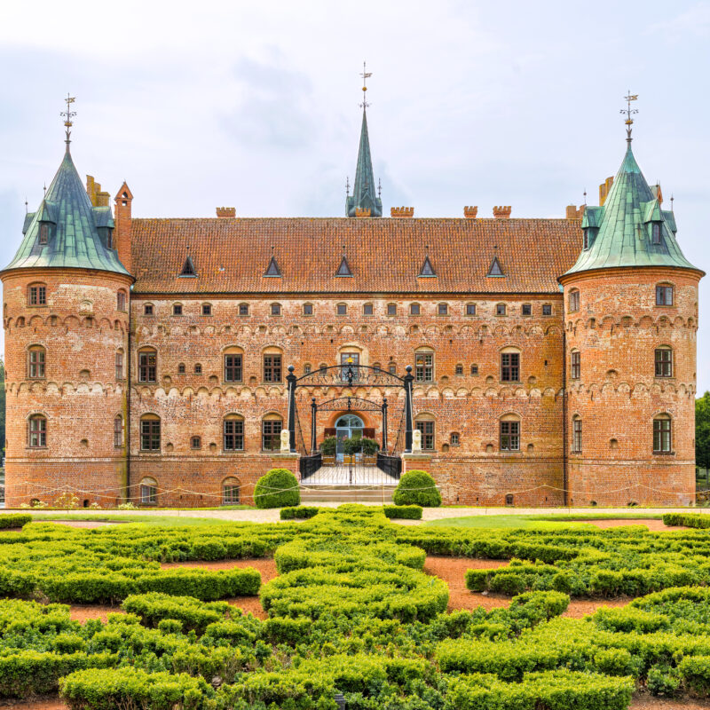
Egeskov Castle
This floating castle appears to be from an enchanted fable, but in actuality it is Europe's best preserved Renaissance water castle.
AWA visted here
Presented with


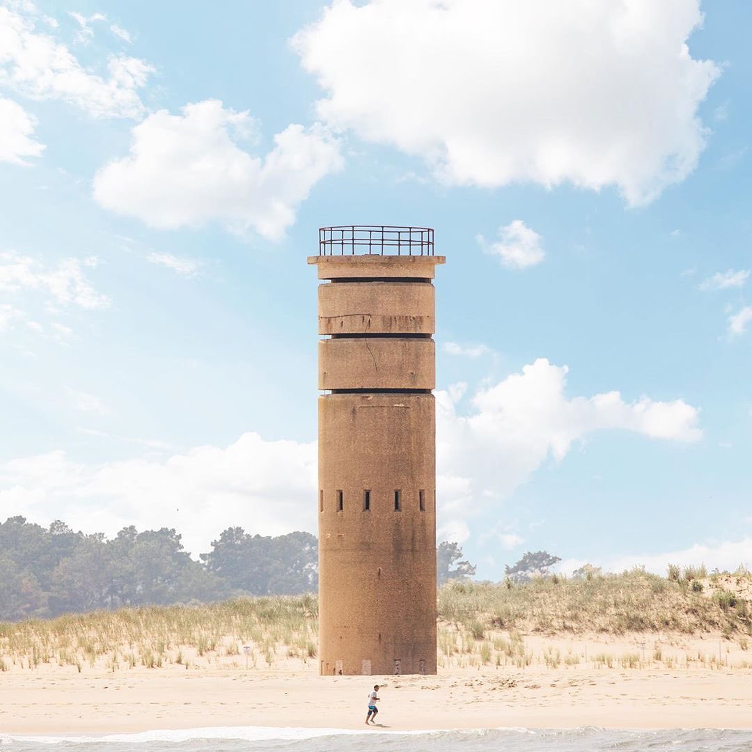
Cape Henlopen, Delaware | C.1964
Partner
Situated at the mouth of the Delaware Bay along the Atlantic Ocean, Cape Henlopen has been open to the public for centuries since William Penn, the founder of the nearby state of Pennsylvania, decreed the area as public lands for the Delaware colony in 1682. Over 200 years later, it officially became Cape Henlopen State Park.
Throughout those 200 years, Cape Henlopen served as a strategic location for many branches of the U.S. military. During the American Revolution, the Henlopen Lighthouse became a lookout for the Continental Army. In the War of 1812, the Cape’s dense trees and terrain deterred the British as they bombarded the nearby town of Lewes for food and supplies. During World War I, a small naval base was built.
Yet, it wasn’t until World War II that a major military presence was established. In 1941, the Army built Fort Miles, a massive military base including 250 buildings, 16 underground bunkers, and concrete observation towers, like the one pictured above. Germany had listed the Delaware Valley as a target during the War due to its manufacturing capabilities, so the U.S. built Fort Miles to monitor and control aerial and maritime activity around the Bay.
Along with the military base, the Cape’s terrain once again aided the Army. Dunes were raised to camouflage guns, ammunition, and bunkers. The observation towers were used to help aim the 16-inch guns hidden in the dunes. Today, many observation towers still remain and are now used for fire control and recreation.
Following the War, the area became Cape Henlopen State Park in 1964. The 5,193-acre Park is open year-round and is a popular spot for beachgoers to fish, bike, surf, and of course, explore the many remnants of For Miles among the dunes.
Looking to read more about this area of the world? This location exists in a guide:
Explore the Guide to our Home State 38.78569, -75.0972831
This floating castle appears to be from an enchanted fable, but in actuality it is Europe's best preserved Renaissance water castle.
AWA visted here
Uditore Fabrizio Grech would say this 1745 country house was built for his daughter, but it was in fact constructed to silence critics of his wealth.
A one-night stay at the Stanley Hotel sparked the inspiration for Stephen King's The Shining.
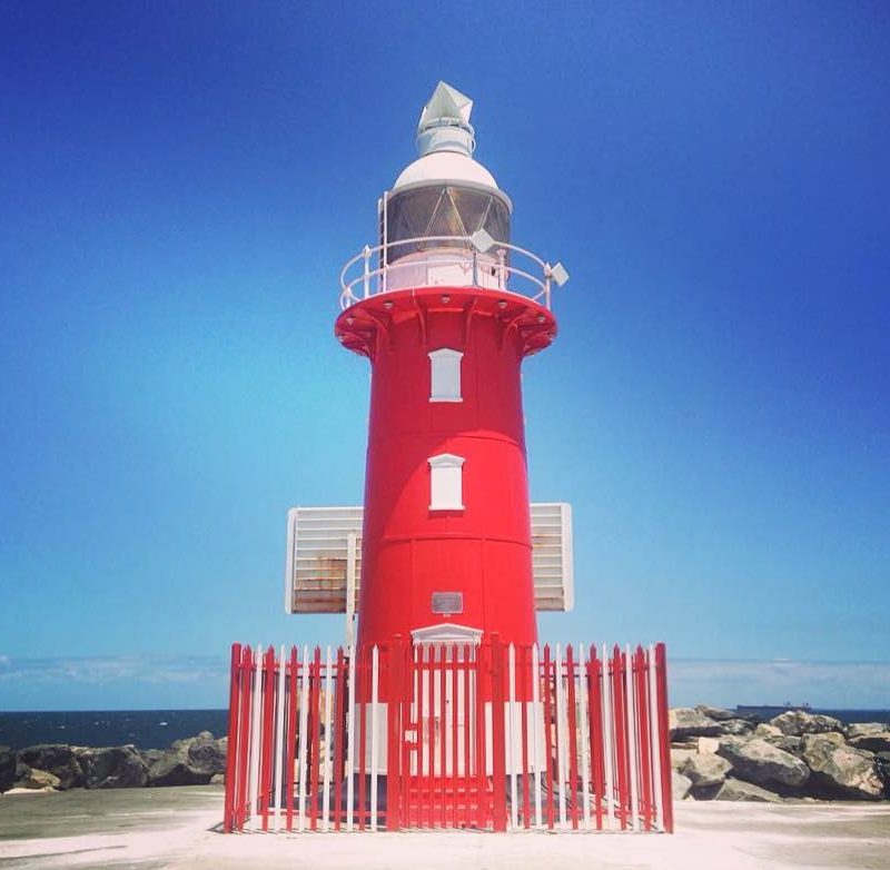
AWA visted hereThe North Mole Lighthouse is one of a pair of "twin" lighthouses found at the entrance to Fremantle Harbour in Western Australia.
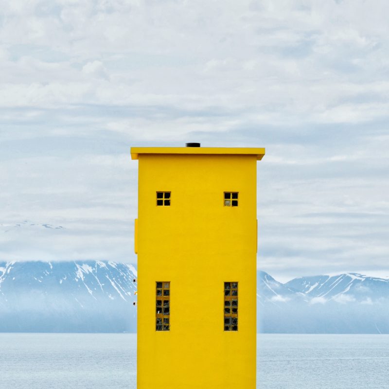
This semicircular-cylindrical light house guards a fishing village in Iceland.
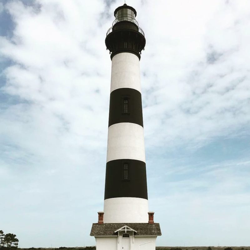
The 170-foot structure is one of only a dozen remaining tall, brick tower lighthouses in the United States.
AWA visted hereMax file size is 40MB. JPEGs are preferred.
You do not have permission to view this form.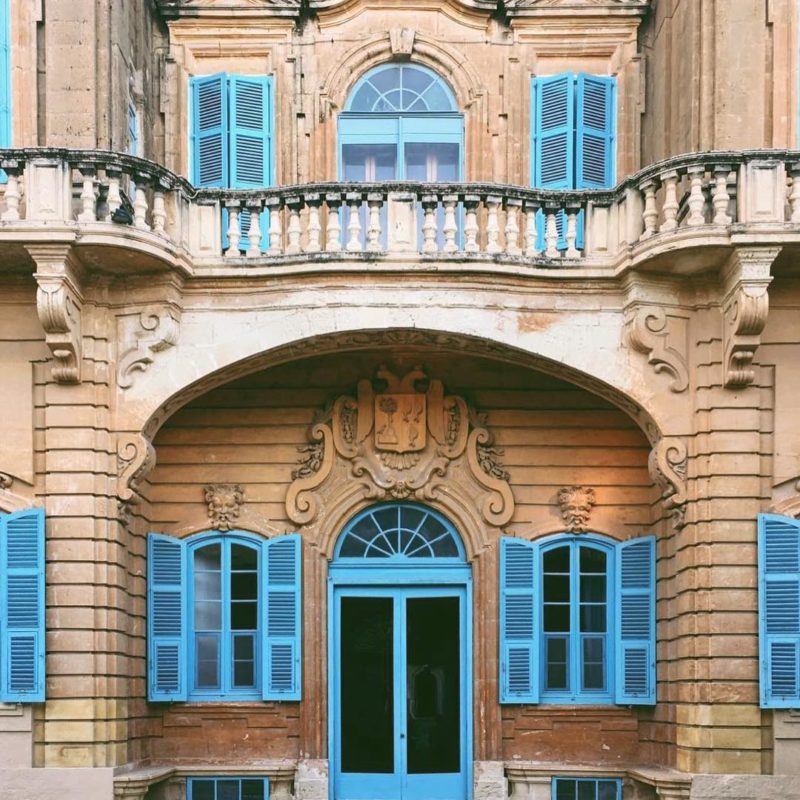

Herring point at Cape Henlopean State Park is he perfect zen spot to pray , relax and enjoy. Also a great surfers beach .